If you’re a geographer, it’s your job to understand and explain the planet’s structure we live on. To do that, you’re going to need a few specialized tools – some simple, some less so – to help you get the job done.
Of course, as technology advances, tools and devices that geographers are using to study the earth are becoming better and better. However, there are still a few traditional bits of equipment no geographer can live without. This article will look at the essentials of every geographer’s toolkit.
Maps
Traditionalists will be pleased to know that there’s still plenty of space for a good old-fashioned map in a geographer’s backpack. Maps are effectively spatial drawings of earth, with different maps serving different functions. Depending on the type of study you want to carry out, you might need a map that details the physical features of the terrain. In contrast, for another project, you might need a map that offers region-specific data such as languages spoken or the main exports of the area.
Regardless, the humble map still plays a vital role when it comes to getting vital information on the terrain you’re on.
Surveying equipment
Surveying equipment is more commonly seen in the construction industry, but it also has a place in geography. Geographers use the equipment for the same purpose – for example, using a theodolite to measure distance and elevation – but simply use the information provided for different purposes related to their studies.
GPS
Bringing things forward to today’s tech-heavy world, geographers use global positioning systems (GPS) to gather detailed information about their current position and the geographical context of the area around them. Two other similar tools used are global information systems (GIS) – which carry a database of geographic information that is constantly updated by various sources – and global direction systems (GDS) – which help users navigate using database information rather than a satellite feed.
Another modern technological helper comes in the form of remote imagery, with geographers using aerial and satellite photography to record images that provide information beyond the visible spectrum, including magnetic activity, infrared temperature, and subterranean water levels.
Thermometers and anemometers
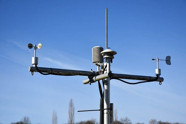
One key element of geography is monitoring the weather to better understand our atmospheric conditions. Now, you’ll almost certainly have heard of a thermometer, but have you heard of an anemometer?
Anemometers are devices that measure wind speed. While they’re primarily used in weather monitoring, they have several other industrial uses and are a tool of choice for geographers. Along with high-end thermometers, you can expect to find one in most geographic settings.
Of course, the expansive world of geographic study boils down to plenty more than the items mentioned above, but these are the primary tools of the trade. An interesting mix of modern technology and traditional equipment, make sure you’ve got both your map and your GPS tracking ready to go on your next geography adventure.
Featured Image by rawpixel.com